The Faroe Islands are still a bit “off the beaten path”, unspoiled and absolutely beautiful. Photos on Instagram for the “islands” over the past year have seen an increase and will entice you. We have been enticed!
Our trip to the Faroe Islands started in Reykjavik. We arrived at the tiny “city” airport near the Reykjavik city center a few hours early. They had free WiFi and a small cafe so we did some “work”. I joke, but the perpetual travel and opportunity we now have to explore “everything”, after being released from our hectic work life of many years, has left us busier than we ever have been…but that’s a good thing.
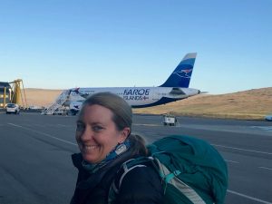 Our 5:20 pm Atlantic Airways (the official airline of the Faroe Islands) flight was delayed until 6:30 pm. The flight to the country of 18 islands located between Iceland and Norway is around one hour. The airline has a whopping total of three planes (Airbus 320s) and two passenger type helicopters.
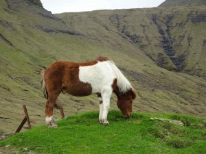
 The Faroes’ have a rugged landscape so trekking poles are handy. Some say that the use of trekking poles, aka “sticks”, take as much as 30 percent of the pressure off of one’s knees. They my help delay my knee replacement procedure, lol (but I digress).
The climate in the Faroes’ is a “sub-polar oceanic climate”. That means windy, wet, cloudy, and cool. Hmmmm…sounds a bit like Iceland. Temps are supposed to be a bit warmer and average above freezing all year…despite being on a similar latitude as Reykjavik. This is apparently due to the Gulf Stream.
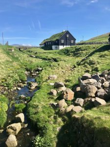
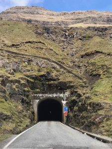
 Our ten day stay was based in the capitol, Tórshavn, the “urban” area where 21,000 of the roughly 50,000 population live. Many of the islands are connected by sea tunnels or accessed via ferry or helicopter. Helicopter flights are roughly the same relatively low price as the ferries. The main airport is located on the island of Vágar. The drive is about 40 minutes through a couple tunnels to our Airbnb in Tórshavn. There are many tunnels, some quite long across the islands. I think someone bought some tunneling equipment and is having a lot of fun playing with it! And it appears they are continuing to build more.
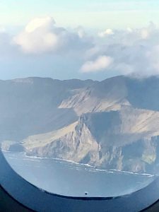
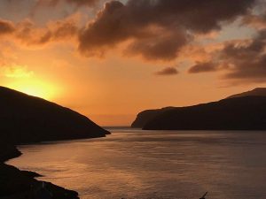 Our flight arrived a bit after nine pm and it was still very sunny. As we drove to Tórshavn around 10 pm, the sun was beginning to set across the jagged mountains and water.
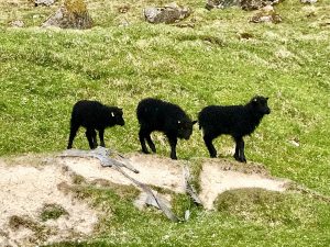
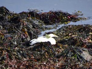
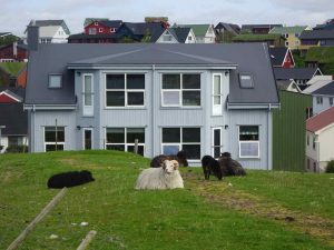
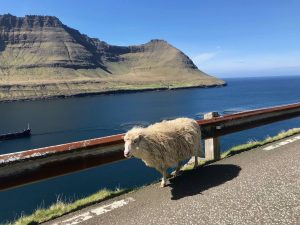
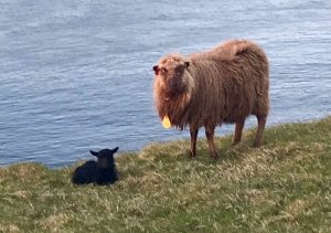 It was lambing season and there were many sheep – ewe, rams and lamb along the road! These sheep are quite different than the thousands and thousands of sheep we have seen across New Zealand and Australia. Kinda interesting…a bit more info here if you are curious.
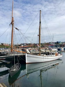
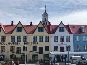
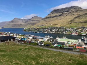
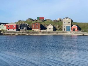
The Capital, Tórshavn
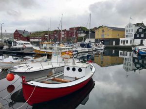
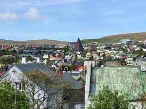 We spent our first morning exploring Tórshavn on foot. The small harbor town is hilly but the small town center area is easy to explore on foot.
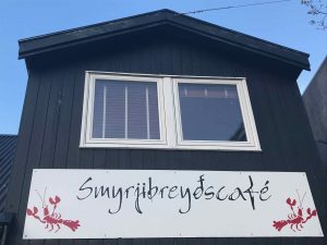
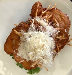
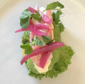
We did lunch at Smyrjibreyds Cafe. It is a rather unique spot that includes noodles but spectacular open face sandwiches, called Smørrebrød. These “open-face” sandwiches include fish, chicken, avocados and vegetarian options. More of these to come when we visit Copenhagen!
The dining options are not voluminous on the Faroes, but we managed to eat at a couple other very good spots. For cheap eats we had fish and chips at, well. Fisk and Chips, lol.
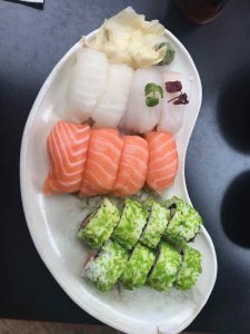
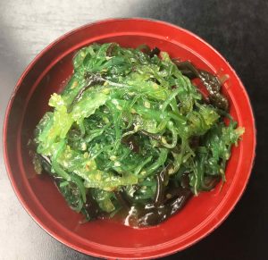 There is actually a pretty good sushi/Japanese Restaurant, Etika. When in Rome, well, lets just say I enjoyed the Halibut, Cod and Salmon sushi! The wakame, or seaweed salad was terrific.
 The place that took the cake was Barbara Fish House. It is located in a cosy, old, small house in the town center. Great fish soup, horse mussels, salted cod and other local favorites paired with some good wine.
 From Velbadstadur you can see the islands of Hestur and Koltur. The scene as you begin your drive down the Nordradalur is beautiful with views of the islands of Vágar, and Koltur.
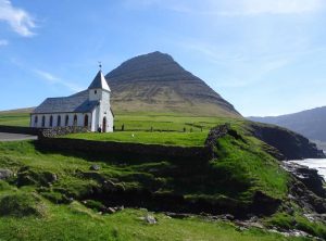
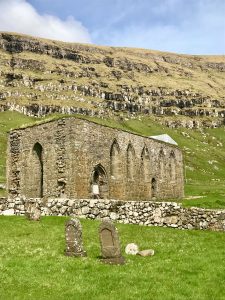
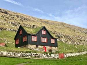
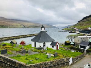 Nearly every small town (and I do mean small ranging from a couple dozen to a few hundred people) has a church with typical similar designs. People settling these towns obviously had in mind the question “what would be the most beautiful spot to put this town?”. The Faroe’s towns and landscapes are idyllic, picturesque, fairytale like!
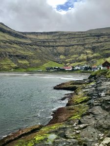
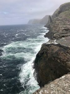
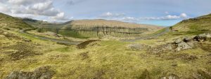
 The northern part of Streymore is of course, outstanding. The area north of Tórshavn takes one through a couple mountain tunnels and eventually to some beautiful drives on one lane roads. There are drives labeled the “buttercup drive” that indicate those of particular beauty and interest, however, one is hard pressed to find a drive that is not.
 The single lane roads take a little getting used to as they truly do only fit one vehicle. These roads have small turnouts typically every couple hundred meters for a vehicle to pull over and allow an oncoming vehicle to pass. There are also a few long, dark (i.e. yes, unlit) “one lane tunnels” around the islands that have turnouts within the tunnels every 100 meters. These are a bit more harrowing (and actually kinda creepy), again, until one gets used to them.
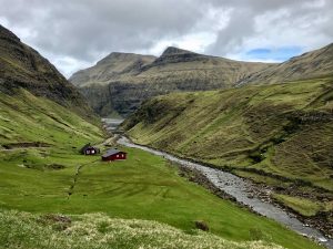
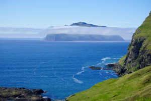
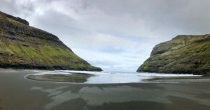 In the North of Streymoy, we visited the small villages of Saksun and Tjørnuvík. The 3 km walk along the lake, waterfalls, cliffs and stream to the Atlantic Ocean and black beach is a must. The trip to the beach must be completed around low tide as the route back is blocked at high tide. Even though it was cloudy, cool and a bit windy, the area is remarkable. This was one of our favorite places in the Faroes. It feels like you are on a different planet.
A one way 8 km hike can take you to the northern town of Tjørnuvík, but given the weather and an initial steep climb, we decided to drive around the fjord to Tjørnuvík on another day.
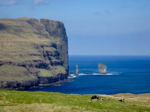
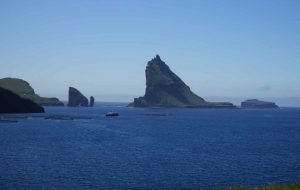
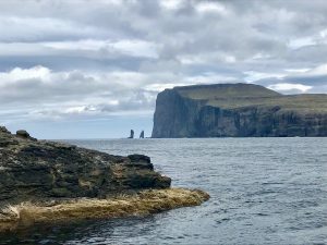
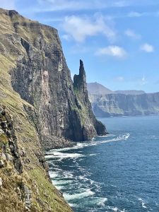
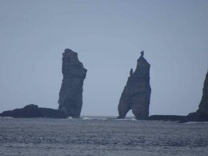 The drive and approach to the town of Tjørnuvík is idyllic, with a view of the town of Eidi on the island of Eysturoy to the east. In the town is a beautiful beach and cliffside walks which has views of the sea stacks, Risin and Kellingin.
The tale of how these were formed is described on the Visit Faroe Islands site:
“Once upon a time, an Icelandic chief witch sent a giant and his wife, a witch, to the Faroe Islands to steal the islands and bring them back to Iceland. Off they went in the dusk and arrived in the north-westernmost part of the Faroe Islands. They decided to tie a rope around a mountain called Eiðiskollur, and pull the Faroe Islands towards Iceland.
They struggled and worked hard to get the rope in place. Their first attempt was unsuccessful because part of the mountain split. However, they were determined and worked all night to make it work.
Like all creatures of the night, the giant and the witch knew they had to hide before the sun came up, for fear of being turned into stone. This particular night, they were so pre-occupied with their task that they failed to notice the first beams of sunlight appearing on the dark horizon. Inevitably, they were turned into stone. Ever since, the giant and the witch have stood, staring westward, longing for their home country.”
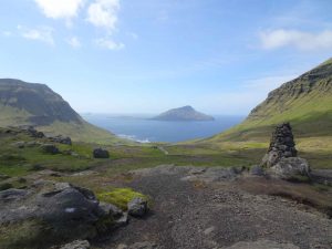
Mykines and the Puffins
 We made two attempts to take a small ferry to the westernmost, virtually unpopulated island of Mykines. Unpopulated by humans that is as this small, jagged island is known for its puffins. It may be the only place in the world where you can practically walk alongside this cliff dwelling bird.
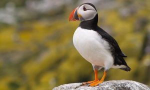
We saw many puffins flying in Iceland and a few here. And they are clumsy flyers! But they are typically difficult to see close up because they like very steep cliffs for their habitat. A picturesque lighthouse and around a 7 km hike to it is also a draw to this island.
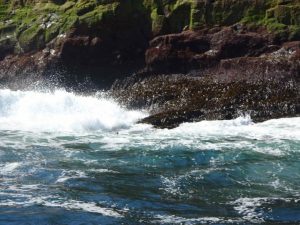 In our first attempt, we made it to the islands eastern edge. The captain instructed us that the waves were too large on the western side of the island. That is where the ferry landing is for the island. While it was a beautiful, sunny day, the Atlantic was churning. We passed a couple young seals that looked like they were nearly drowning trying to stay afloat near some rocky cliffs. I don’t know, maybe they were just having fun.
We tried again the next day, again sunny, but the ferry was cancelled before even leaving the port. But the idyllic opportunities are many and we took advantage of the “free day” to explore more amazing terrain.
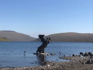
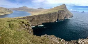 We hiked around 7 km along the largest lake in Faroe Islands, Lake Sørvágsvatn or Leitisvatn on Vágar Island (Among the locals, there is disagreement regarding the name of the lake). The lake remarkably appears suspended 40 meters above the Atlantic Ocean, surrounded by jagged cliffs and magnificent formation that seems to push up into the sky.
 The lake “empties”into the ocean via a waterfall, Bøsdalafossur. This 100 foot high waterfall creates the perspective that the lake is even much higher above the sea.
 Another nearby stop is to see Trøllkonufingur, or “Witches Finger” (the more direct translation is actually “Troll woman’s finger). This 1,000 feet plus high monolith is a short walk if you manage to drive down the narrow, rocky, one lane road just outside of the town of Sandavágur. Legends are big in these parts and of course this formation has one.
“Legend has it, that Trøllkonufingur is the finger of a witch that came to throw the Faroe Islands to Iceland. When she came to the sea south of Vágar, the sun came up and she was turned into stone and fell into the ocean.” http://visitvagar.fo/welcome-to-vagar/about/stories-and-legends/troellkonufingur/
Slættaratindur
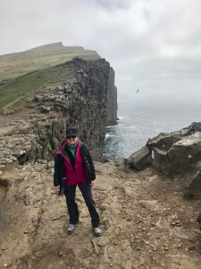
 During our stay I managed to climb the highest peak in the Faroe Islands, Slættaratindur. The peak is 818 meters high (around 2,900 feet) It is located in the northern part of the island of Eysturoy, between the villages of Eiði, Gjógv, and Funningur.
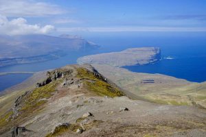
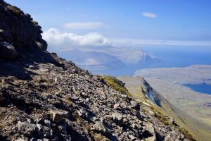 The 6 km round trip hike can probably be done in about 90 minutes, but I spent over two hours given the absolutely outstanding views of the area. With wind gusts perhaps as high as 50 mph near the top, I was taking it slow on the eroded gravelly, ice-covered peak! It was a bit nerve-racking given my more recent acquisition of fear of heights. But well worth it!
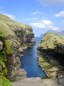
 After the walk, we drove to the very small town of Gjogv. The word translates literally to “gorge”. The beautiful sea-filled gorge runs 200 meters out into the Atlantic Ocean.
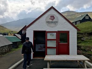 Not much here but we did stop at a shop, maybe the only one, for a coffee and ice cream.
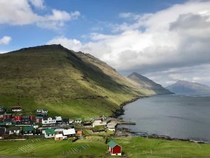
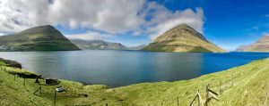 Funningur Fjord was another beautiful stop in the northwest area of the Eysturoy Island.
Klaksvik
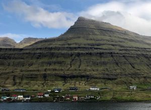
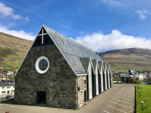 Klaksvík, located on the island of Borðoy with beautiful surroundings is the second-largest town in the Faroe Islands with a population of approximately 4,800 inhabitants. The fishing capital of the Faroes’ features the 1963 Christianskirkjan, or “Christian’s Church” named after King Christian X of Denmark.
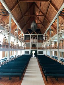
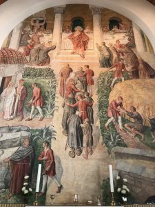 The church has a few interesting features. It has a beautiful, 19th-century wooden boat hanging from the ceiling. It also contains a remarkable painting that was originally created by the Danish church artist Joakim Skovgaard in 1901 as a fresco for the cathedral church in the Danish city of Viborg. The paining resided in the National Museum of Denmark until many years later it was placed in this church.
 We took a short ferry trip to Nolsoy to hear some live music at Maggies. The small venue is popular with locals, has good food and live music on the weekends during the summer.
 We heard some great music from Lena Anderssen…and of course enjoyed a couple pints before catching the ferry back to Torshvan with the musicians and most of the other pub patrons.
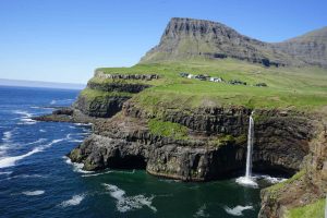
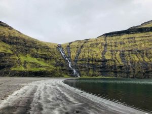
 On our final day in the Faroes we did a bit more sightseeing on Vagar. We visited the very small village of Gasadalur. The cliffs, waterfall and views are spectacular here. Gasadalur used to be one of the most isolated villages in the Faroe Islands. The village was only accessible across a rugged mountain trail, until a tunnel was bore in 2004 through the mountain. The town nearly became uninhabited due to the limited access. Now there are maybe a couple hundred residents. You can see the small village just above the waterfall in the picture.
We spent ten un-rushed days on the islands that provided a wonderful way to wind down, relax and reflect. The Faroe Islands are a magical place to visit with landscapes that are unique, idyllic and breathtaking. The islands are still relatively untouched, all making a visit here high on one’s bucket list.
And a few more pics…